
Gorecht (Omgevingsvisie)
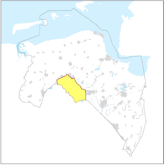
Dit bestand bevat het gebied Gorecht zoals opgenomen in de Omgevingsvisie van de provincie Groningen. Het is één van de zeven deelgebieden uit de kwaliteitsgids landschap. Het Gorecht bestaat uit het parkachtig esdorpenlandschap van de Hondsrug met twee reeksen esdorpen overgaand in open beekdalvlakten van de Hunze en de Drentsche Aa, waarin vrijwel geen bebouwing voorkomt.
Standard
dataIdentificatie
- Title
-
Gorecht (Omgevingsvisie)
- Date (Publication)
- 2026-06-06
- Unique resource identifier
-
541cabdd-2fa2-4901-9348-2466a0a260ad
- Status
- Completed
- Metadata language
- Nederlands; Vlaams
-
Interprovinciale thesaurus
-
-
LANDSCHAPSONTWIKKELING
-
CULTUURLANDSCHAPPEN
-
RUIMTELIJKE ORDENING
-
LANDELIJKE GEBIEDEN
-
Omgevingsvisie
-
OMGEVINGSWET
-
Ambitie
-
RUIMTEGEBRUIK
-
BELEIDSPLANNEN (VORM)
-
RUIMTELIJKE KWALITEIT
-
- Use limitation
-
Geen gebruiksbeperkingen.
Legal constraints
- Access constraints
- Other restrictions
- Other constraints
- Geen beperkingen
- Point of contact
-
individualName organisationName electronicMailAddress role Team Atelier ruimtelijke kwaliteit en landschap
Provincie Groningen
Owner
spatialInfo
))
- Denominator
- 50000
- referenceSystemIdentifier
DataQuality
- Hierarchy level
- Dataset
- Lineage
-
provincie Groningen, kwaliteitsgids landschap
Metadata
- Metadata language
- Nederlands; Vlaams
- Hierarchy level
- Dataset
- Metadata author
-
individualName organisationName electronicMailAddress role Datateam Beleid
Provincie Groningen
Point of contact
)))