
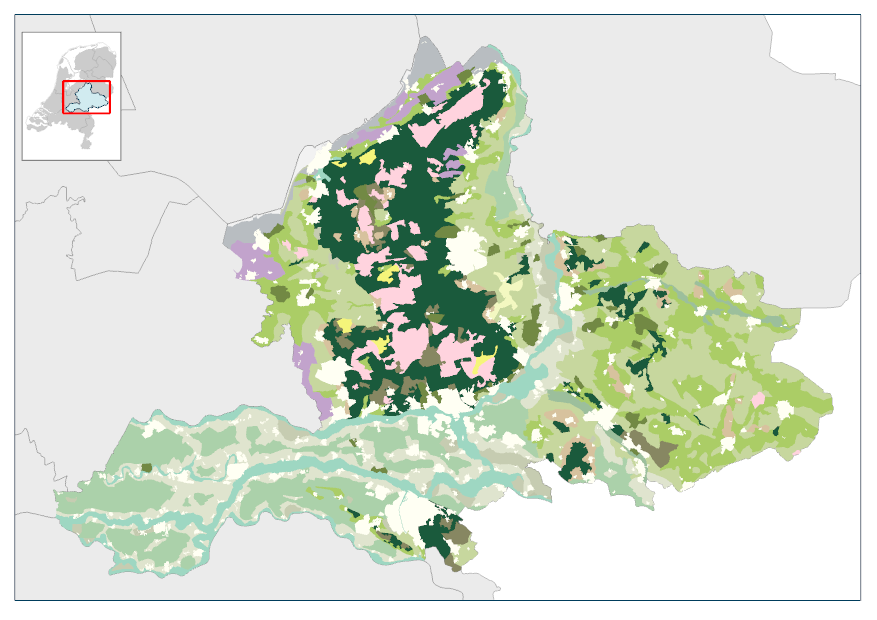
Landschapstypen 19nu
In dit bestand wordt provincie Gelderland opgedeeld in landschapstypen. In totaal zijn er 20 verschillende landschapstypen: o.a. kassenlandschap, natte heide- en broekontginningenlandschap, en essenlandschap.Het landschapsbeeld van Gelderland wordt beschreven in 5 deelrapporten (1985). Het bestand is opgesteld en gebruikt ten behoeve van het Streekplan 1996 dat op 25 september 1996 is vastgesteld door Provinciale Staten.
Standard
dataIdentificatie
- Title
-
Landschapstypen 19nu
- Date (Creation)
- 1985-01-01
- Date (Revision)
- 2008-08-20
- Status
- Historical archive
- Metadata language
- Nederlands; Vlaams
-
Interprovinciale thesaurus
-
-
NATUUR EN LANDSCHAP
-
- Use limitation
-
Geen gebruiksbeperkingen
Legal constraints
- Access constraints
- Other restrictions
- Other constraints
- Geo Gedeeld licentie
spatialInfo
))
- Denominator
- 50000
- referenceSystemIdentifier
DataQuality
- Hierarchy level
- Dataset
- Lineage
-
De gegevens zijn afgeleid van analoog kaartmateriaal afkomstig van het deelrapport uit 1985.
Metadata
- Metadata language
- Nederlands; Vlaams
- Hierarchy level
- Dataset
- Metadata author
-
individualName organisationName electronicMailAddress role ProvincieLoket
Provincie Gelderland
Point of contact
)))
