
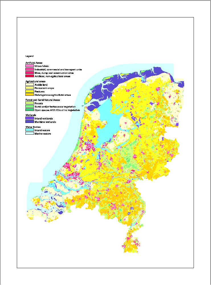
CORINE Land Cover database van Nederland voor het jaar 2000
De database bevat data betreffende het landgebruik in Nederland volgens de Europese CORINE Land Cover legenda. De data zijn met name gebaseerd op de visuele interpretatie van Landsat7-ETM beelden uit 1999 en 2000. De Nederlandse database wordt geintegreerd met andere nationale databases om voor de gehele EU een standaard landgebruiks database te hebben. Deze database kan o.a. gebruikt worden voor het uitvoeren en monitoren van Europees milieubeleid.
Monitoring Land Cover Changes between 1986 and 2000. Alterra, the Netherlands
2. Thunnissen, H.A.M. and Middelaar, H.J. van, 1995. The CORINE Land Cover database of the Netherlands. Final report of the CORINE Land Cover project in the Netherlands. Report 78. Alterra, the Netherlands
3.EEA and ETC-TE, 2002. CORINE Land Cover update I&CLC2000 project. Technical Guidelines. Final Version. EEA, Denmark
Simple
Basis
- Title
-
CORINE Land Cover database van Nederland voor het jaar 2000
- Unique resource identifier
-
3b0135d1-debf-4c1a-9121-f9e13d0378cf
- Status
- Completed
-
GEMET - Themes, version 2.4
-
-
Landgebruik
-
Orthobeeldvorming
-
Satellietbeeld
-
- Date (Revision)
- 2006-10-17
- Point of contact
-
organisationName electronicMailAddress role Wageningen Environmental Research
Owner EEA- European Environment Agency
Owner
- Use limitation
-
Bronvermelding
- Use limitation
-
a) not to use the data for commercial purposes;
b) to acknowledge the source of the data in all publications and applications;
c) to help improve the quality of the data by noting and reporting any errors or omissions discovered;
d) to help improve the quality of the Data Service by giving feed back on functionalities and data packaging the data provided;
e) to help improve the co-ordinated use of data by informing EEA staff about applications which use data from the Data Service;
f) to help improve the efficiency of environmental reporting by supplying the EEA with documented digital copies of data and information derived from EEA data so that it can be re-used by the Agency with reference to the source;
g) to supply the EEA with a copy of /URL to all publications and other products based on the datasets;
- Access constraints
- Intellectual property rights
- Use constraints
- Copyright
- Other constraints
-
Copyrighthouder: Wageningen Environmental Research
spatial
))
- Denominator
- 100000
Metadata
- Metadata author
-
organisationName electronicMailAddress role Wageningen Environmental Research
Author
)))
