
Fysisch Geografische Regio's WMS
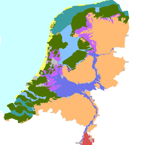
Indeling van Nederland in Fysisch-Geografische Regio's. Voor de omgrenzing van de Regio's is een zo consistent mogelijke lijst van beslisregels gehanteerd, vooral gebaseerd op de bodemtypen. Dit bestand is een update van de FGR-versie van 1997.
Dutch profile
dataIdentificatie
- Title
-
Fysisch Geografische Regio's WMS
- Date (Creation)
- 2013-11-14
- Date (Revision)
- 2024-11-14
- Point of contact
-
individualName organisationName electronicMailAddress role Beheer PDOK Custodian
- Keywords
-
-
Biogeografische gebieden
-
spatialInfo
N
S
E
W
))
Temporal coverage
Restricties en beperkingen
- gmd:useLimitation
-
Geen beperkingen
gmd:MD_LegalConstraints
- gmd:accessConstraints
- Other restrictions
- gmd:otherConstraints
- Geen beperkingen
Service operaties en gekoppelde bronnen
- srv:couplingType
- Tight
- Service type
- view
- srv:containsOperations
-
srv:operationName srv:DCP GetCapabilities
WebServices
coupledResource
- srv:operatesOn
Service kwaliteit
- gmd:level
- Service
- levelDescription
-
service
DQ_ConceptualConsistency
About the metadata
- gmd:language
- Nederlands; Vlaams
- gmd:characterSet
- UTF8
- gmd:hierarchyLevelName
-
service
- Point of contact
-
individualName organisationName electronicMailAddress role Beheer PDOK Point of contact
- gmd:metadataStandardName
-
ISO 19119
- gmd:metadataStandardVersion
-
Nederlands metadata profiel op ISO 19119 voor services 2.1.0
Fysisch geografischeregios
