
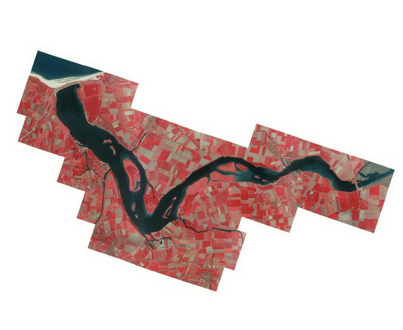
Orthofotomozaiek Veerse Meer 2011
Orthofotomozaiek Veerse Meer Falsecolour 2011 vervaardigd uit stereoluchtfoto opnamen op 25/05/2011 ter ondersteuning van Ecotopen 2011 monitoringsprgramma in opdracht van de Waterdienst.
Standard
dataIdentificatie
- Title
-
Orthofotomozaiek Veerse Meer 2011
- Date (Creation)
- 2011-08-19
- Unique resource identifier
- 6bfe735f-89e8-4d7c-8840-730640cf0629
- Status
- Completed
- Metadata language
- Nederlands; Vlaams
- Keywords
-
- Use limitation
-
Geen beperkingen
Legal constraints
- Use limitation
-
Geen beperkingen
- Access constraints
- Other restrictions
- Use constraints
- Other restrictions
- Other constraints
- Geen beperkingen
Security constraints
- Classification
- Unclassified
- Point of contact
-
individualName organisationName electronicMailAddress role Servicedesk Data
Rijkswaterstaat https://www.rijkswaterstaat.nl/formulieren/contactformulier-servicedesk-data
Distributor
spatialInfo
))
- Distance
- 5 meters
- referenceSystemIdentifier
- RD_New
- referenceSystemIdentifier
- NAP
DataQuality
- Hierarchy level
- Dataset
- Lineage
-
Luchtfoto's false color, Product is vervaardigd volgens specificaties dienst luchtfoto's en orthofotomozaieken versie 1.0 van de CIV
Metadata
- Metadata language
- Nederlands; Vlaams
- Hierarchy level
- Dataset
- Metadata author
-
individualName organisationName electronicMailAddress role Servicedesk Data
Rijkswaterstaat https://www.rijkswaterstaat.nl/formulieren/contactformulier-servicedesk-data
Point of contact
)))
