
2014
Contact for the resource
Keywords
License
Type of resources
Categories
Service types
protocol
Years
revisionDateYears
publicationDateYears
-
CORINE Land Cover change (2006-2012) database of the Netherlands. Monitoring of CLC land cover changes between 2006 and 2012 with a minimum mapping unit (MMU) of 5ha. The CORINE Land Cover (CLC) initiative has a longstanding tradition of providing land cover and land use information over Europe at regular time intervals. Over the past few decades, it gradually became one of the flagship european geospatial datasets. For the 2012 release, the global Monitoring for Environment and Security Programme (GMES, now called Copernicus), established in partnership with the European Commission and the European Space Agency (ESA), provides a unique opportunity to extend the CLC products with a new series of High Resolution (HR) layers, adressing 5 land cover characteristics that will provide valuable complementary information to the CLC datasets (i.e. imperviousness, forest areas, permanent grassland, wetlands and water bodies). The European Environment Agency (EEA) is responsible for the coordination of the pan-European component of GMES Initial Operations (GIO) Land Monitoring 2011-2013 in the framework of regulation (EU) No 911/2010 – Pan-EU Component. As the EEA highly values the cooperation with EIONET members and cooperating countries they were invited to participate in the production of CLC products and verification and enhancement of the HR layers.
-
CORINE Land Cover 2012 database of the Netherlands. Land cover of the Netherlands in 2012 based on satellite imagery in combination with ancillary data with reference date around 2012. Land cover mapping according to the CLC class descriptions with minimum mapping unit 25ha. The CORINE Land Cover (CLC) initiative has a longstanding tradition of providing land cover and land use information over Europe at regular time intervals. Over the past few decades, it gradually became one of the flagship european geospatial datasets. For the 2012 release, the global Monitoring for Environment and Security Programme (GMES, now called Copernicus), established in partnership with the European Commission and the European Space Agency (ESA), provides a unique opportunity to extend the CLC products with a new series of High Resolution (HR) layers, adressing 5 land cover characteristics that will provide valuable complementary information to the CLC datasets (i.e. imperviousness, forest areas, permanent grassland, wetlands and water bodies). The European Environment Agency (EEA) is responsible for the coordination of the pan-European component of GMES Initial Operations (GIO) Land Monitoring 2011-2013 in the framework of regulation (EU) No 911/2010 – Pan-EU Component. As the EEA highly values the cooperation with EIONET members and cooperating countries they were invited to participate in the production of CLC products and verification and enhancement of the HR layers.
-
CORINE Land Cover 2006 database of the Netherlands (revised). Land cover of the Netherlands in 2006 based on satellite imagery in combination with ancillary data with reference date around 2006. Land cover mapping according to the CLC class descriptions with minimum mapping unit 25ha. The CORINE Land Cover (CLC) initiative has a longstanding tradition of providing land cover and land use information over Europe at regular time intervals. Over the past few decades, it gradually became one of the flagship european geospatial datasets. For the 2012 release, the global Monitoring for Environment and Security Programme (GMES, now called Copernicus), established in partnership with the European Commission and the European Space Agency (ESA), provides a unique opportunity to extend the CLC products with a new series of High Resolution (HR) layers, adressing 5 land cover characteristics that will provide valuable complementary information to the CLC datasets (i.e. imperviousness, forest areas, permanent grassland, wetlands and water bodies). The European Environment Agency (EEA) is responsible for the coordination of the pan-European component of GMES Initial Operations (GIO) Land Monitoring 2011-2013 in the framework of regulation (EU) No 911/2010 – Pan-EU Component. As the EEA highly values the cooperation with EIONET members and cooperating countries they were invited to participate in the production of CLC products and verification and enhancement of the HR layers.
-

In dit figuur is de opgave en herkomst met betrekking tot Stikstof (N) in ons oppervlaktewater op hoofdlijnen weergegeven
-

Door Provinciale Staten van Drenthe op 2 juli 2014 vastgestelde versie van Gebiedsontwikkeling Groningen Airport-Eelde. In de Luchtvaartnota van het Rijk (2009) is Groningen Airport Eelde (GAE) aangewezen als luchthaven van nationale betekenis. Dit biedt de luchthaven de ruimte zich verder te ontwikkelen als luchthaven die bijdraagt aan de internationale bereikbaarheid van met name Noord-Nederland. Komt voor in kaart 1: Visie; kaart 4: Robuust sociaal-economisch systeem.
-

Door Provinciale Staten van Drenthe op 2 juli 2014 vastgestelde versie van Sturingsniveaus cultuurhistorie.De provincie Drenthe maakt onderscheid tussen drie sturingsniveaus: respecteren, voorwaarden stellen en eisen stellen. De sturingsniveaus zijn gebiedsgericht toegepast en weergegeven in de beleidskaart in het Cultuurhistorisch Kompas.Komt voor in kaart 2F: Cultuurhistorie Kernkwaliteit.
-

Door Provinciale Staten van Drenthe op 2 juli 2014 vastgestelde versie van Zwemplassen. De door de provincie aangewezen zwemplassen op grond van de "Wet hygiene en veiligheid badinrichtingen en zwemgelegenheden".Komt voor in kaart 9: Kaderrichtlijn Water.
-

Door Provinciale Staten van Drenthe op 2 juli 2014 vastgestelde versie van Natura 2000 (aanduiding).Binnen het natuurnetwerk zijn de Natura 2000-gebieden van internationaal belang. Hierop is Europese regelgeving van toepassing. Voor elk Natura 2000-gebied wordt een beheerplan opgesteld voor het behouden en ontwikkelen van de natuurwaarden. Het gedeelte van het natuurnetwerk waar de provincie Drenthe voor verantwoordelijk is, is de begrensde EHS. Komt voor in kaart 2C: Kernkwaliteit rust.
-
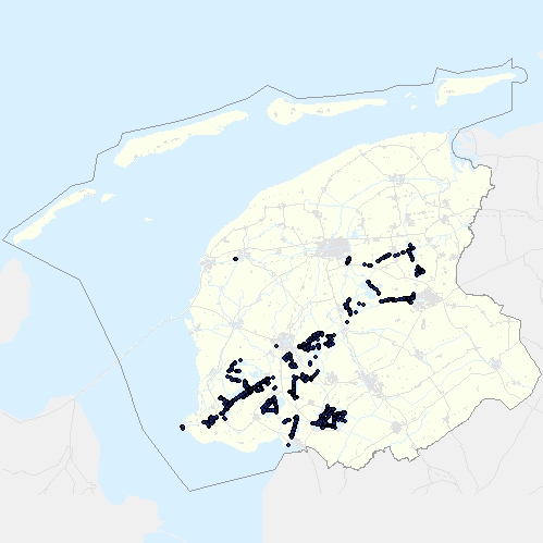
Betonning van vaarwegen in Fryslân, onder provinciaal beheer. Bevat onder andere de locatie van boeien en lichtopstanden (vaste bakens).
-

Door Provinciale Staten van Drenthe op 2 juli 2014 vastgestelde versie van Zonering vliegveld. De Regeling Burgerluchthavens en Militaire luchthavens (RBML) geeft ons bevoegdheden over alle luchtvaartactiviteiten en luchthavens (inclusief helikopterlandingsplaatsen), met uitzondering van Groningen Airport Eelde. Eventuele verzoeken voor nieuwe luchtvaartactiviteiten toetsen we aan de wettelijke normen en aan ons beleid zoals vastgelegd in de "Beleidsnota Luchtvaart Drenthe" (2010). Ook houden we rekening met de regelgeving over Natura 2000- en stiltegebieden. Komt voor in kaart 3: Milieu- en leefomgevingkwaliteit.